
Local
Written by: David Elliott
Publication date: 11-02-2022
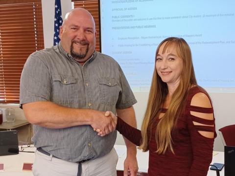
Megan Koetkemeyer was recognized Tuesday by the Russell City Council for her award from the Kansas Association of Mappers for the interactive cemetery map she created for the City of Russell Cemetery.
Koetkemeyer is the City’s GIS and Planning Technician whose job is to work with various departments to map City infrastructure and assets according to City staff.
Its maps and associated data have been integral in creating the city’s asset management program, advanced meter deployment, resource deployment and faster response in specific areas of the city and territory. of electric service 50 miles.
The Kansas Association of Mappers (KAM) is a professional mapping and Geographic Information Systems (GIS) society in Kansas founded in 1986.
Each year, KAM sponsors a card gallery at its annual conference to give members the opportunity to exhibit their work. Winners are based on popular vote.
In her first submission, Koetkemeyer received third place for best digital masterpiece at the KAM conference for the interactive map she created for the Town of Russell Cemetery.
This interactive map, available on the City’s website, offers families and researchers an online tool to locate specific cemetery plot locations, availability, and the ability to initiate an online plot purchase.
(Information courtesy of the Town of Russell.)